


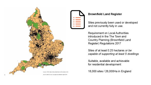
The Brownfield Land Register was introduced through The Town and Country Planning Regulations 2017 and requires Local Authorities to register their brownfield sites. Across the whole of England there are 18,000 brownfield sites identified across 338 authorities an area totalling 260km², which is roughly the size of Birmingham. The sites need to capable of supporting at least five dwellings and be suitable and available for residential redevelopment.
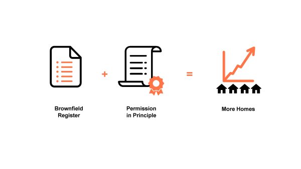
Permission in Principle came into force in June 2018. It is intended to reduce the risk getting consent for developers of smaller brownfield sites: less than 1 hectare, 9 residential units or less, and no more than 1000m² of floorspace. Permission in Principle was hailed as being quicker and more predictable planning process to deliver more homes. With the housing crisis in London – the Mayor has a target to deliver just under 650,000 homes over 10 years – we were curious as to what part Permission in Principle might play in helping to resolve the demand for housing.
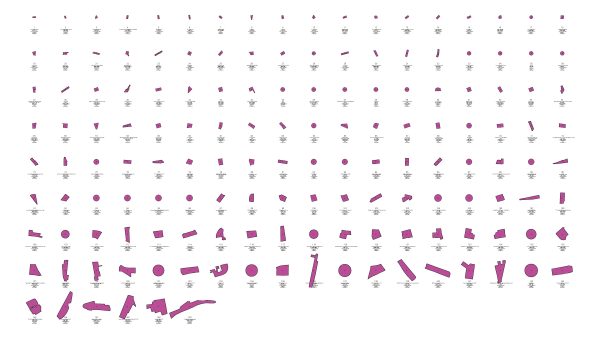
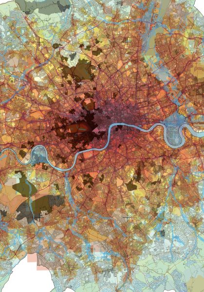
We developed a technique of mapping and modelling the register data to help visualise the urban scale and spread of registered sites across Greater London. We collated a complete set of all 32 London Boroughs brownfield registers. By our count there are currently over 3000 sites on the brownfield register across Greater London. Approximately two thirds already have planning permission approved. The remaining third do not. This totals 29km² of brownfield, an area approximately the size of the London Borough of Southwark
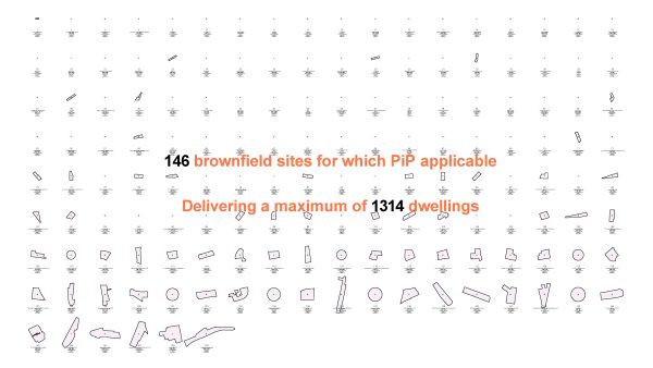
When reviewing sites without planning permissions and applying the criteria for Permission in Principle: those sites that are less than 1Ha, where the local authority has applied a minimum dwelling count of 9 or less; only 146 sites appear to be applicable. This equates to only 5% of the total registered sites in London. And within the boundaries of Permission in Principle these are limited to 9 dwellings. Which means there is only scope for these 146 sites to deliver of maximum 1,314 dwellings. So, whilst the Brownfield Register includes a substantial quantity of land: 3000 sites, 29km², with projected homes potentially totalling 340,000, the Permission in Principle criteria applies to less than 5% of the available sites. It would constitute just 0.2% of the mayor’s 10-year target for homes. We concluded that Permission in Principle in London neither unlocks nor de-risks development at scale.
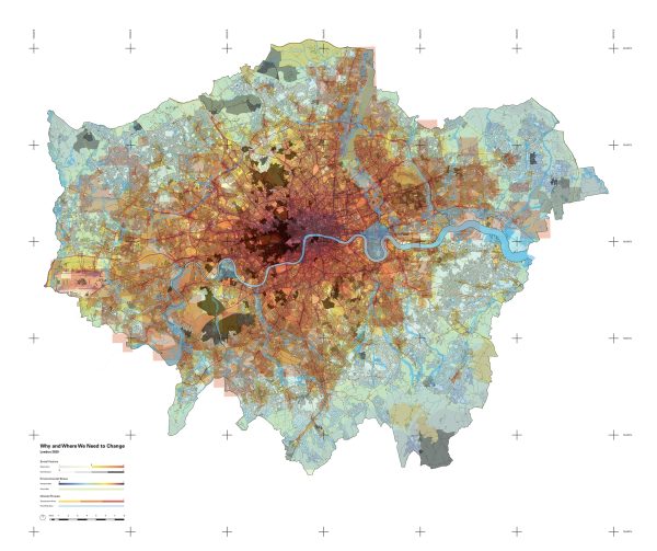
Having mapped all of the registered brownfield sites across the capital, we became inquisitive as to what else could be done with this data. By combining other data sets with our existing computational model and brownfield mapping we developed a collection of a models and maps which shines new light on brownfield across London. Mapping data such as Air Quality, Living Environment, Deprivation and Flood Risk. Raising questions about their development potential and local needs. It was this work which was exhibited in the Royal Academy Summer Exhibition 2020.
The research concluded that there is huge potential to map available brownfield sites with increasing combinations of data sets to help inform site specific briefs and design solutions. Data-based mapping of brownfield land has the potential to add significant informed development and societal value to redevelopments on both a macro and micro level.